Start of Main Content
Canalway Trail Map
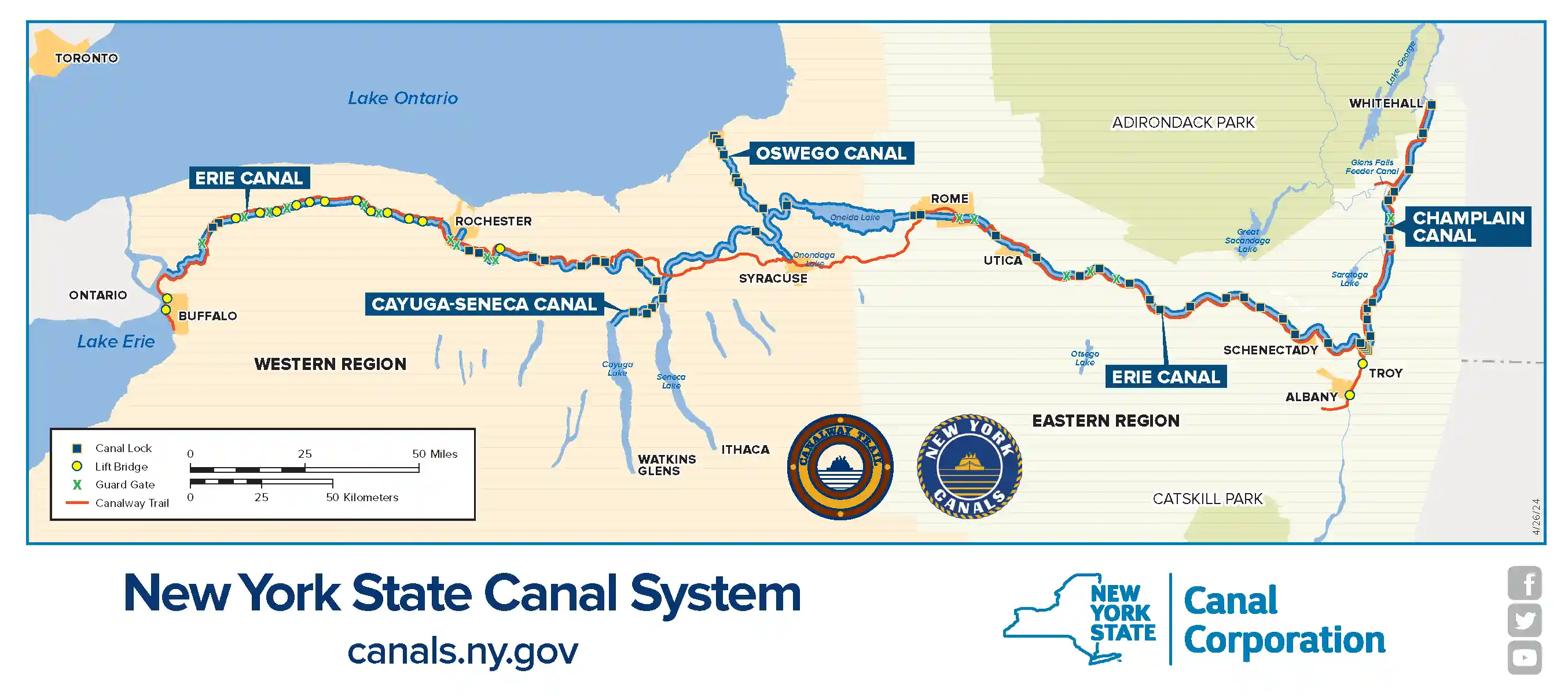
Developed in collaboration with Parks & Trails New York, our interactive map is the perfect tool for mariners, hikers, cyclists, paddlers, campers, and any other visitors hoping to maximize their time along the Canals. Use the NYS Canal System map to plan activities, identify points of interest and more!
Includes a map of the Erie canal, Champlain canal, Cayuga-Seneca canals, and Oswego canals, as well as related waterways.

Want to learn more about the myriad activities available along the Canals? Check out the sections below!
Trail Visits, Cycling & Paddling
No matter your method of navigation, plan an enjoyable up-close journey along the NYS Canal System.
Recreational Boating
Information about boating and everything beyond including details on locks, lift bridges and guard gates.